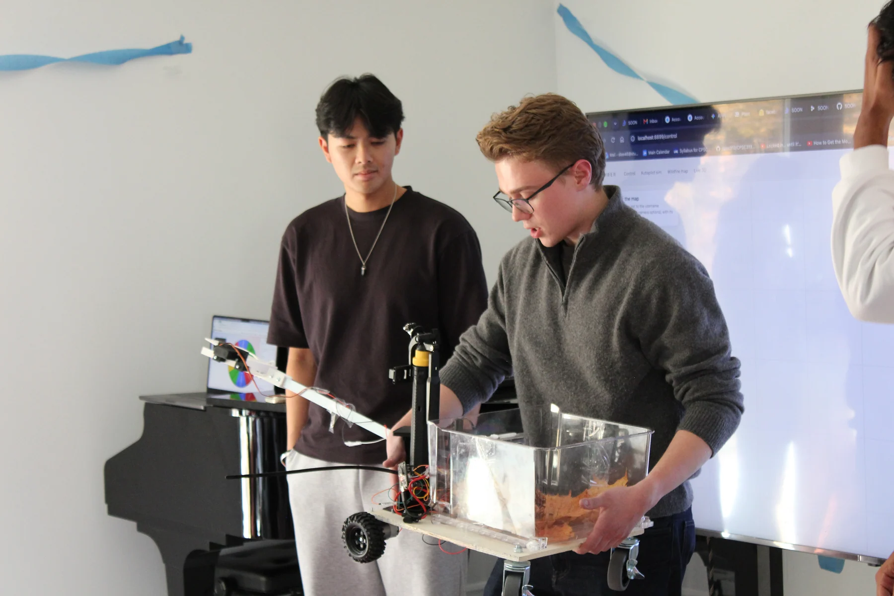
From identifying exposure to taking action
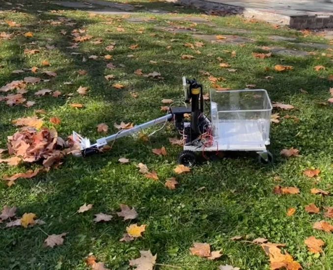
The wildfires in Northern Ontario that summer prompted a question: how could we connect identifying wildfire exposure with the physical work of reducing combustible material? Ember paired an experimental mapping platform with a custom rover designed to gather loose leaves and other surface debris and move them to a collection point.
The aim was a connected workflow: use regional information to investigate a site, use a phone to inspect the ground, and eventually use the robot to carry out targeted maintenance.
- 01 / InvestigateWildfire-exposure map
Combine fuels, satellite imagery, buildings and weather; compare experimental fire-spread scenarios.
- 02 / InspectPhone perception
Detect leaves, track the camera pose and place observations into a local spatial map.
- 03 / ActuatePhysical rover
Command the drive motors and arm through the ESP32, with a scoop and bin designed for debris collection.
Custom mechanics, embedded control
I took the physical platform from CAD through fabrication and electrical bring-up: a custom chassis with independently commanded geared drive motors, an aluminium square-tube arm, and a bearing-supported rotating base with high-torque pan and lift servos. The mechanism connected printed structural parts and shaft couplings to off-the-shelf actuators, with the collection bin and phone mast integrated onto the same platform.
- Mechanisms and CAD: designed the printed servo mounts, shaft couplings, tube interfaces and collection tooling, including a servo-actuated closing scoop.
- Fabrication and assembly: printed and fitted the parts, assembled the arm and drivetrain, and mounted the collection bin and phone mast.
- Electrical integration: brought together the battery, motor drivers, regulated servo power, signal wiring and ESP32 controller.
- Embedded control: developed ESP32 C++ firmware with a Wi-Fi dashboard and HTTP control API for wheel and servo commands. A drive-command watchdog stops the wheels when control updates time out.
The build crossed several interfaces: a servo horn had to transfer torque into a printed coupling; the bearing-supported structure had to carry the arm; and the phone-side software needed a predictable way to send commands to the embedded controller. Getting those interfaces to fit and work together was the core of my contribution.
Explore the CAD in 3D
Drag to rotate. Scroll or pinch to zoom. With a model focused, use the arrow keys to rotate, + / − to zoom, and R to reset.
Full rover · early integration concept
Arm, chassis and rear collection box. This earlier design includes an elbow and reference camera; the final build differs.
3D geometry loads when this model comes into view.
Pan / lift mechanism
Printed frame, bearing-supported shaft, lift carrier and drive interfaces.
3D geometry loads when this model comes into view.
Direct-mounted closing scoop
Closing-jaw design on the square tube, without an elbow. Servo and hardware envelopes are schematic.
3D geometry loads when this model comes into view.
These display meshes are derived from the project’s existing CAD and assembly guides. Each view is scaled independently. The full rover is an early concept, not an as-built scan; the photographs show the assembled prototype. Reference hardware and later fit revisions may differ. These are portfolio views, not manufacturing or assembly instructions.
A phone for a brain
The team’s Expo / React Native app turned the iPhone into a perception and spatial-computing platform, while my ESP32 firmware provided the hardware-control interface.
On-device AI and spatial leaf mapping
OWL-ViT ran directly on the iPhone through ExecuTorch with Core ML delegation. Precomputed text embeddings focused detection on leaves and leaf piles without cloud inference. The app smoothed detections across frames, checked available depth and ground geometry, and used repeated sightings to confirm entries in a persistent leaf map in world coordinates.
From camera capture to explorable 3D
ARKit supplied camera poses, per-frame intrinsics and LiDAR depth on supported devices. Native capture exported images, camera transforms and a seed point cloud as a Nerfstudio-compatible dataset. Vercel Blob and an Upstash Redis queue connected capture to a Bun training agent running Brush, with intermediate previews and finished 3D Gaussian splats returned to the browser. The pipeline used the recorded camera poses rather than estimating camera motion from scratch.
Shared navigation, repeatable simulation
The phone and browser simulator ran the same TypeScript navigation code. Simulated scenarios exercised obstacle corridors, approach planning, missed-pickup retries and the complete scoop–return–dump sequence. The ESP32 handled wheel-drive commands, servo targets and drive-command timeouts, keeping high-level perception and navigation separate from low-level actuation.
The wildfire-prevention software
A Python geospatial pipeline combined Ontario’s forest-fuel raster with Overture building footprints and roads to calculate nearby fuel exposure. Sentinel-2 imagery added seasonal canopy-greenness change, while Canadian Wildland Fire Information System readings and Open-Meteo wind data supplied current environmental context.
The Next.js interface brought these layers into a MapLibre map with interactive fire-spread scenarios. A browser worker ran a simplified Canadian Forest Fire Behavior Prediction model, letting users compare simulated outcomes with and without debris clearing, vegetation management and fuel-break interventions. The interface connected the question of where fuel accumulates with what could change if that fuel were treated.
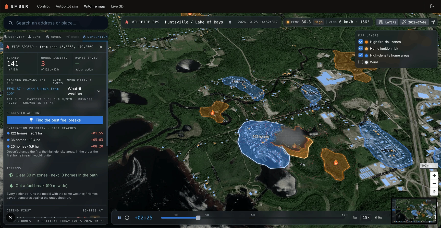
The software connected three scales of observation: regional satellite and geospatial data, site-scale 3D reconstruction, and ground-level robot perception. My hardware and embedded control work gave that software a physical platform to command.
Building under real constraints
Parts of the mechanism were designed and printed before I travelled from Paris to Canada, with fabrication and integration continuing at SOON. Even with a mansion as our workspace, the weekend included an emergency trip to Aurora Public Library to print missing parts and a last-minute search for wheels. Seeing the assembled rover out on the lawn after that was a memorable milestone.
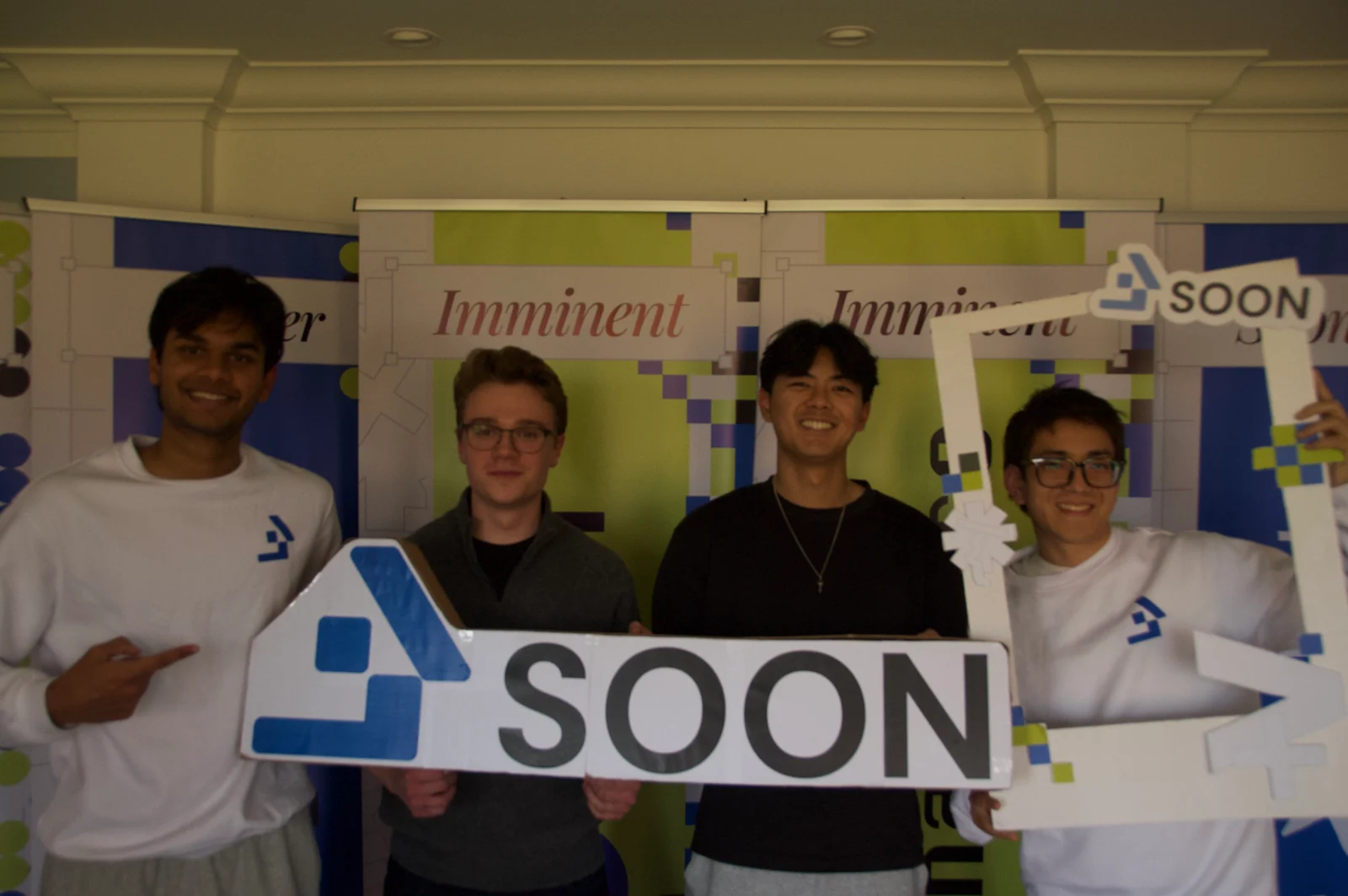
The project won the Best Startup Award at SOON Fall 2026, bringing together custom electromechanical hardware, mobile AI, spatial reconstruction and geospatial software in one team-built system.